Downloadable Route Summary & Instructions for Allendale Town to Nenthead
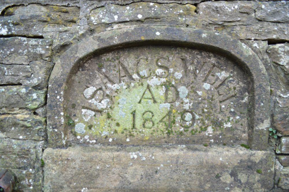
The trail begins begins in Allendale from Isaac’s Well and follows the River East Allen up the valley. The river is mostly out of view but the path never strays far from it, passing through wooded denes over tributary burns or across hay meadows or where sheep, cattle and horses graze. Behind such pastoral images is a fascinating industrial history when the valley led the world, albeit briefly, in mining technology.
By the mid 1800s it was the Silicon Valley of its day with revolutionary hydraulic engines from W.G. Armstong’s Elswick works in Newcastle installed in the shafts to drain Blackett Level mines under construction. So named after the landowners, the Blackett Beaumonts, it was an ambitious engineering project for an underground channel up from Allendale to Allenheads. It was also intended to discover new mineral veins. In the long run, the costly scheme was not a success. The surveying and engineering required may owe something to Allendale’s claim to be the Centre of Britain.
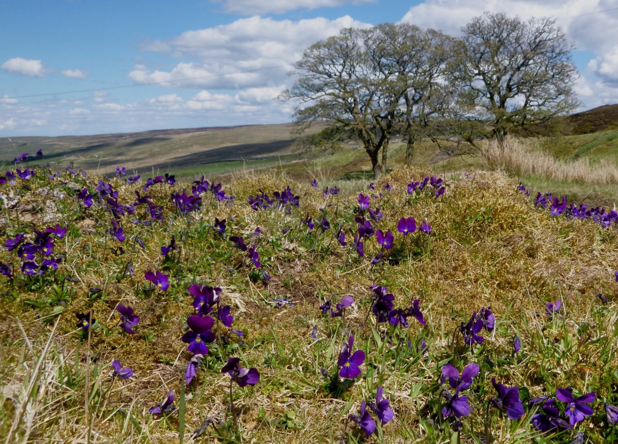
After four miles, the trail turns its back on the East Allen beyond Pry Hill and the Rowantree Stob Bastle (defensive farmstead) ruin and turns for a steady climb up on to the moors on the Black Way. Apparent is the paraphernalia of grouse shooting with feeding stations and marker posts, complete with lines of stone and timber reinforced butts. Other than for spells when grouse shooting is underway from 12th August into the autumn, it’s mostly tranquil. People are few and far between with just the cries of lapwings, calls of curlews and tweets from golden plover on the tops for company around the nesting times. Under the watchful eye of the occasional bird of prey such as the short-eared owl.
In the heyday of the lead mines this route was much travelled with heavily laden ponies making their way over the moors carrying lead ore to be smelted. Walking this open and weather-worn landscape, it is hard to imagine the great fortune carried away from below with no more than an indistinct track as a reminder. Ahead the mass of Killhope looms, where the counties of Northumberland, Durham and Cumbria meet.
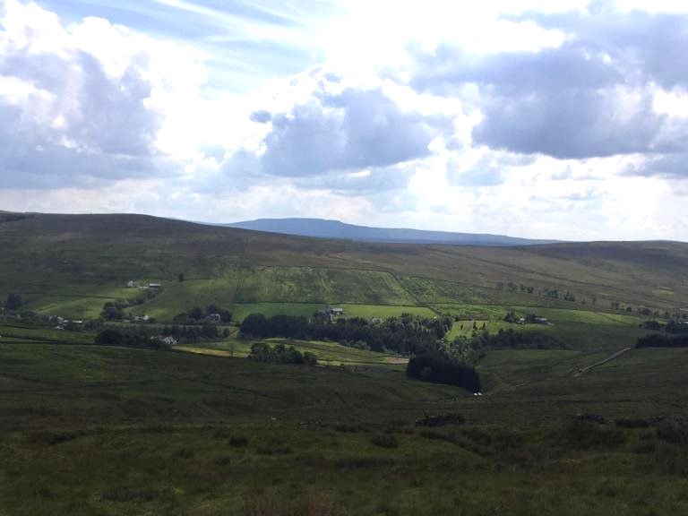
The trail drops down to the overlooked hamlet of Coalcleugh. In the 1700s this was also at the forefront of mining innovations and home to upwards of 200 miners and their families, with a public house, library, allotments, chapel and a rectory. Before casting an eye down the West Allen Valley, the path climbs to its highest point (585m) and then descends from the moors to the village of Nenthead and Cumbria.
Accommodation and refreshments are available in Nenthead. Accommodation is also available at Carrshield: www.carrshieldcampingbarn.co.uk
Distance: 18.51kms, 11.5 miles; Allow 6 hours
Difficulty: Medium
Max height: 581m; Min height: 211m; Total Climb: 586m;
Maps: Allendale Town to Nenthead
Route Instructions
Allendale (Isaac’s Well) GR NY 838558 – Pry Hill, East Allen GR NY 839518
Distance 5.51 km or 3.42 miles
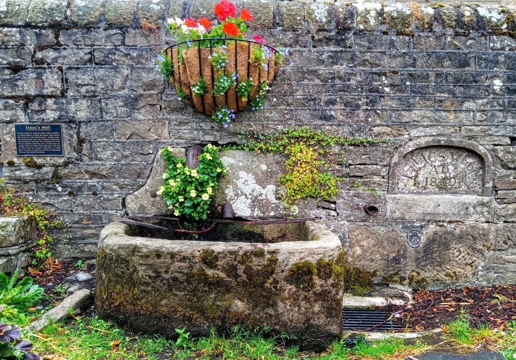
Isaac’s Well is on the edge of the Market Place on the left as you enter Allendale from Hexham or Haydon Bridge. A few paces further along the road go right at the signpost to Alston and Carrshield. Follow as the road twists down to the old Corn Mill Bridge over the River East Allen. Isaac’s Tea Trail is signposted to the left to the track.
(Don’t be confused by a logo sign returning on the other side of the road. This description is based on the circular trail taking a clockwise direction from Allendale facing South and up the East Allen Valley).
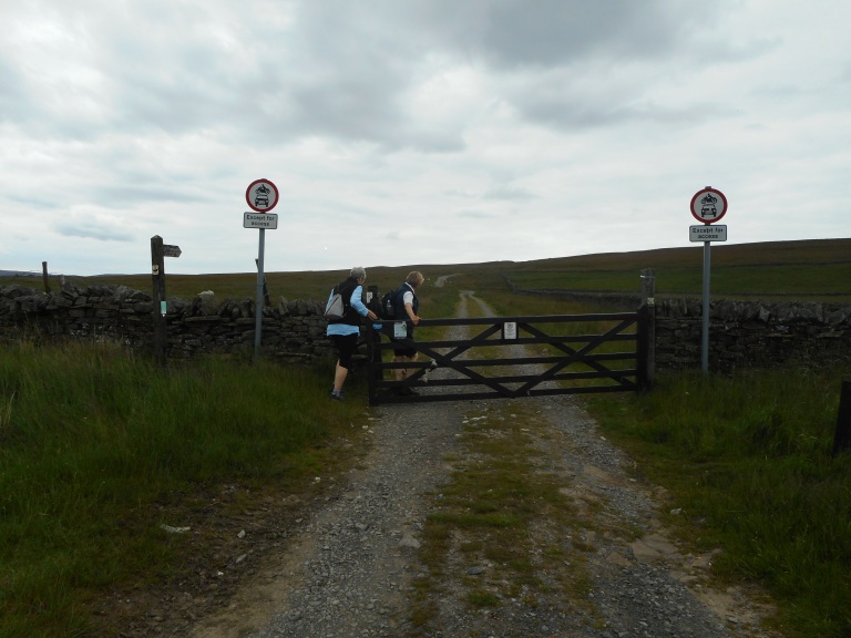
Follow the tarmac lane by the river side to a white wicket gate. Continue by the river and where the field narrows climb the stile at the far end. Follow the narrow path as it leads over stiles to a field gate beneath trees. The next mile or so requires close attention to the signage and map as it loops round.
Proceed along the field edge as far as the stile, cross a couple more fields until a junction of paths and drystone walls. Go through the metal wicket gate, next to the field gate and follow the path, where additional signs are displayed to the marker post with a trail directional arrow (yellow arrow with green edge). The path drops down the slope to the left, to a field gate, passing a cottage on the left and down steps to the Steel Burn footbridge.
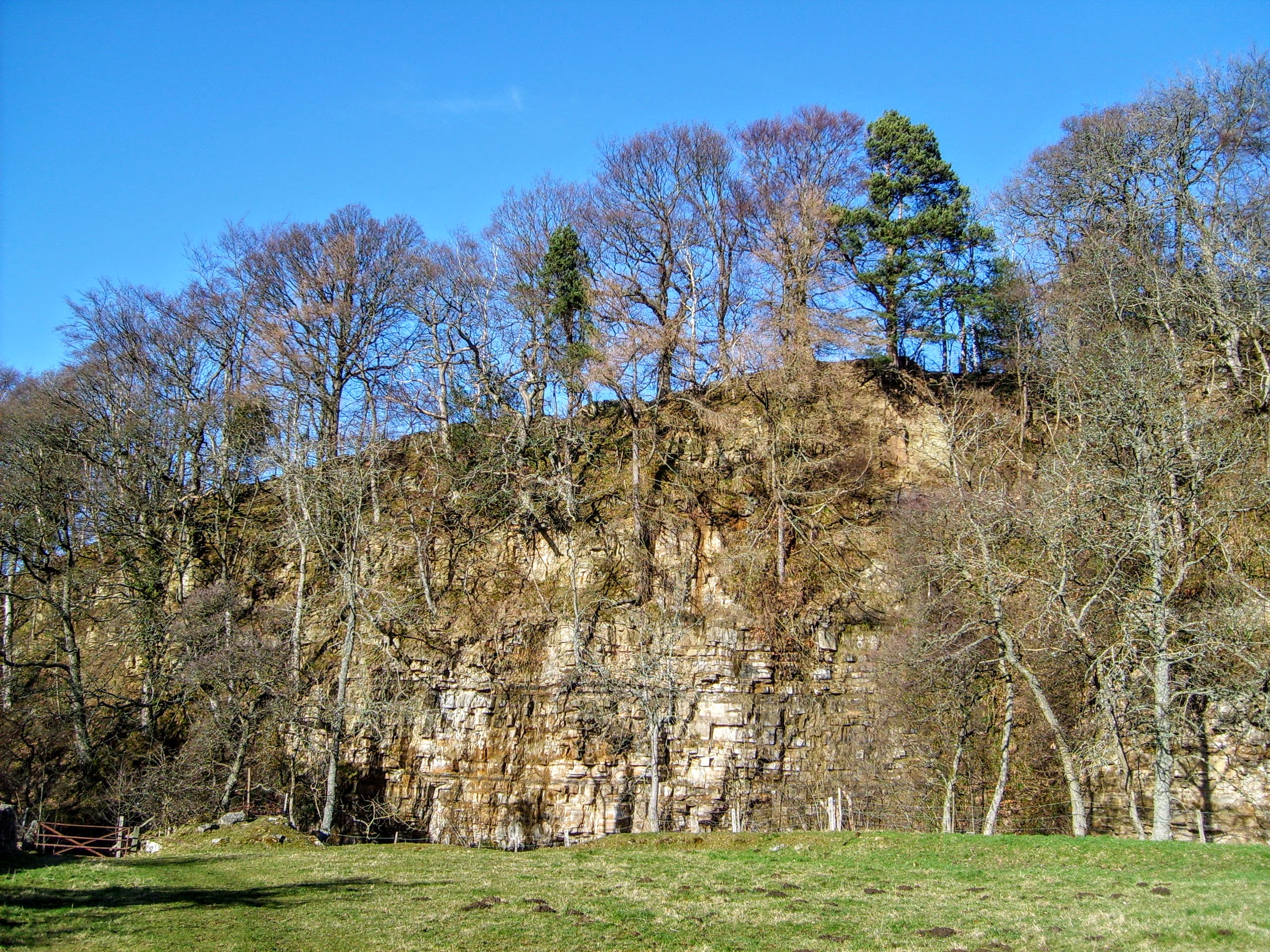
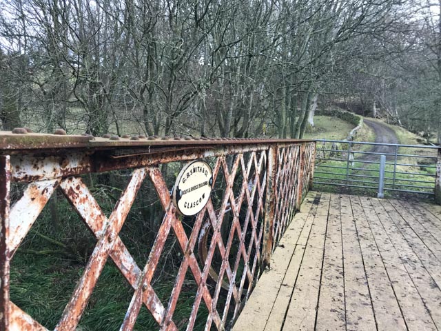
Continue once more by the banks of the River East Allen past the Peckriding footbridge over the river and towering craggs opposite. Follow through the meadow near the riverside, past a ruin and along an often muddy track, leading out to the field beyond to the iron lattice work bridge up to Studdon. Don’t cross the bridge, but keep on the same side of the river through a metal wicket gate (Mavis’ Gate) as far as Park Farm. At Park Farm keep the farm and barns on your right and continue above the tree-fringed riverside.
Soon the path drops down wooden steps to cross the dene and a footbridge, climbing once again to emerge onto a low ridge. Pass the four-way way footpath sign complete within its own enclosure and continue following the footpath sign marked Pry Hill. Cross a further two fields towards the Acton Burn.
Particular care is required in the drop down of 40 yards to the right of hawthorn bushes hidden from view, to the footbridge. Then turn left to the board walk and up the steps, climbing up to a stile in the fence and over another field to the road at Pry Hill.
Pry Hill GR NY 839518 to the Black Way GR NY838500 – See map
Distance 2.21 km or 1.37 miles
Total distance walked = 7.72 km or 4.80 miles
Turn right on the road past the driveway for Pry Hill farm and then left over the stile next to a field gate. At the end of the farm look out for the stile on the left in the drystone wall. Go through the wicket gate opposite and turn right past outbuildings to a field gate beyond.
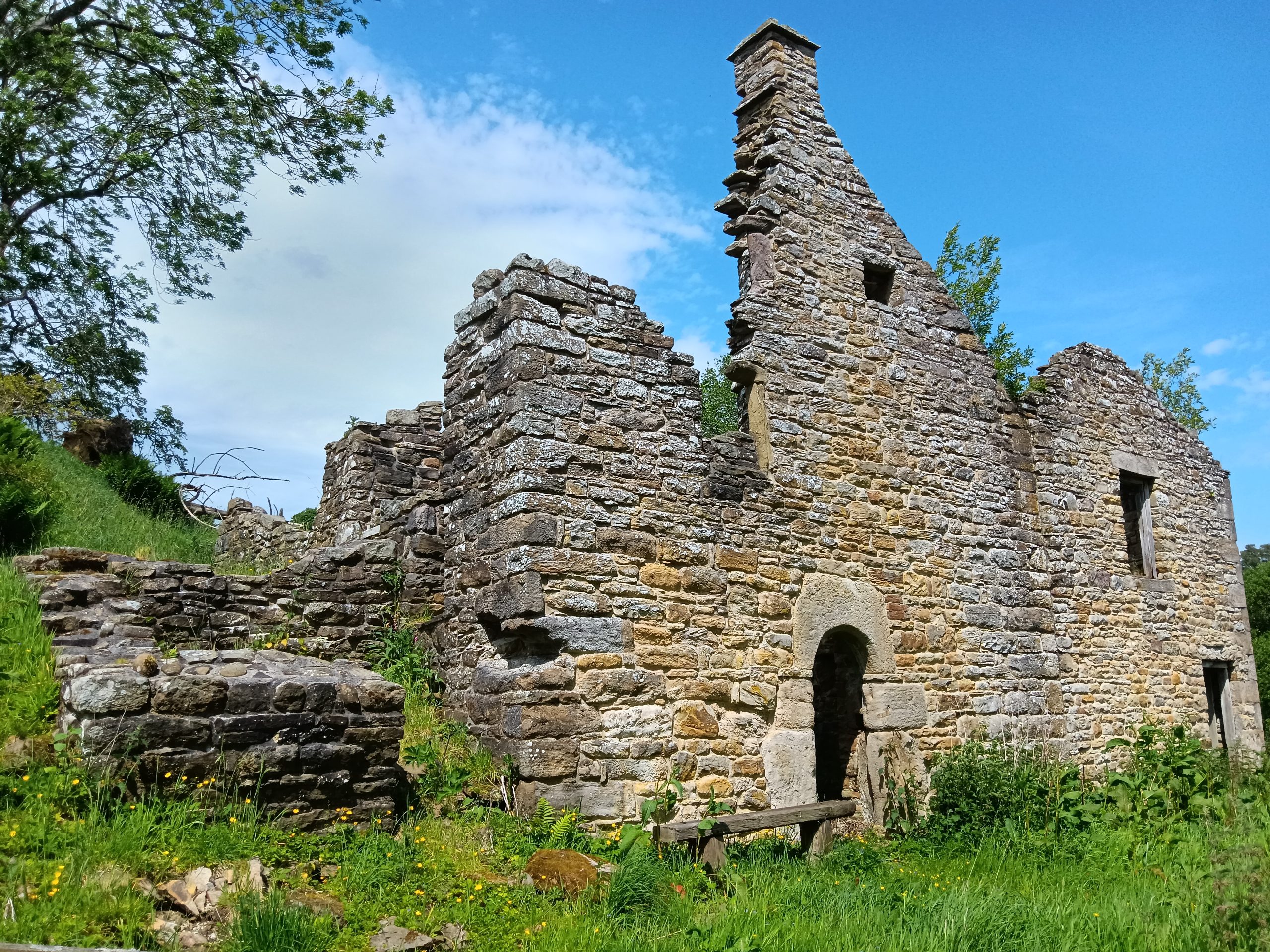
Because of a land slip, the path now takes a minor detour indicated by a marker post to a flight of steps down and around to drop down to cross the Knockburn, where it flows into the River East Allen. Follow to the right the meanders of the burn upstream to the footbridge to Rowantree Stob bastle
Continue on past the ruin with the Knockshield Burn to the left through the gate or nearby stile as far as the marker post. To the left is a short drop to the footbridge over the Hole Sike and out of sight. Cross and climb up and follow the fence line through wicket gates and stiles, to pass the entrance to Knockburn on your left. Then continue straight by the fence line over a further stile and the drystone wall. Keep close to the wall where the ground has fallen away on the left overlooking the burn.
Reaching the road, turn left over the Knockshield Burn and continue on to the road junction. Then go right and gradually uphill past the drive to High Knockshield farm. The road comes to an end at the field gate to the track up the Black Way.
Black Way GR NY 838500 to Coalcleugh GR NY 801451 – See map
Distance 6.57 km or 4.08 miles
Total distance walked = 14.29 km or 8.80 miles
Follow the track onto the moor. Take care to turn left at a fork in the track over a culvert and white marker stones (don’t continue straight up). Follow the path alongside the track to the three-way bladed sign and veer right signposted Isaac’s Tea Trail to Coalcleugh. Follow the regular wooden marker posts (not to be confused by other posts for grouse beaters or grit feeder stations found near this bridleway).
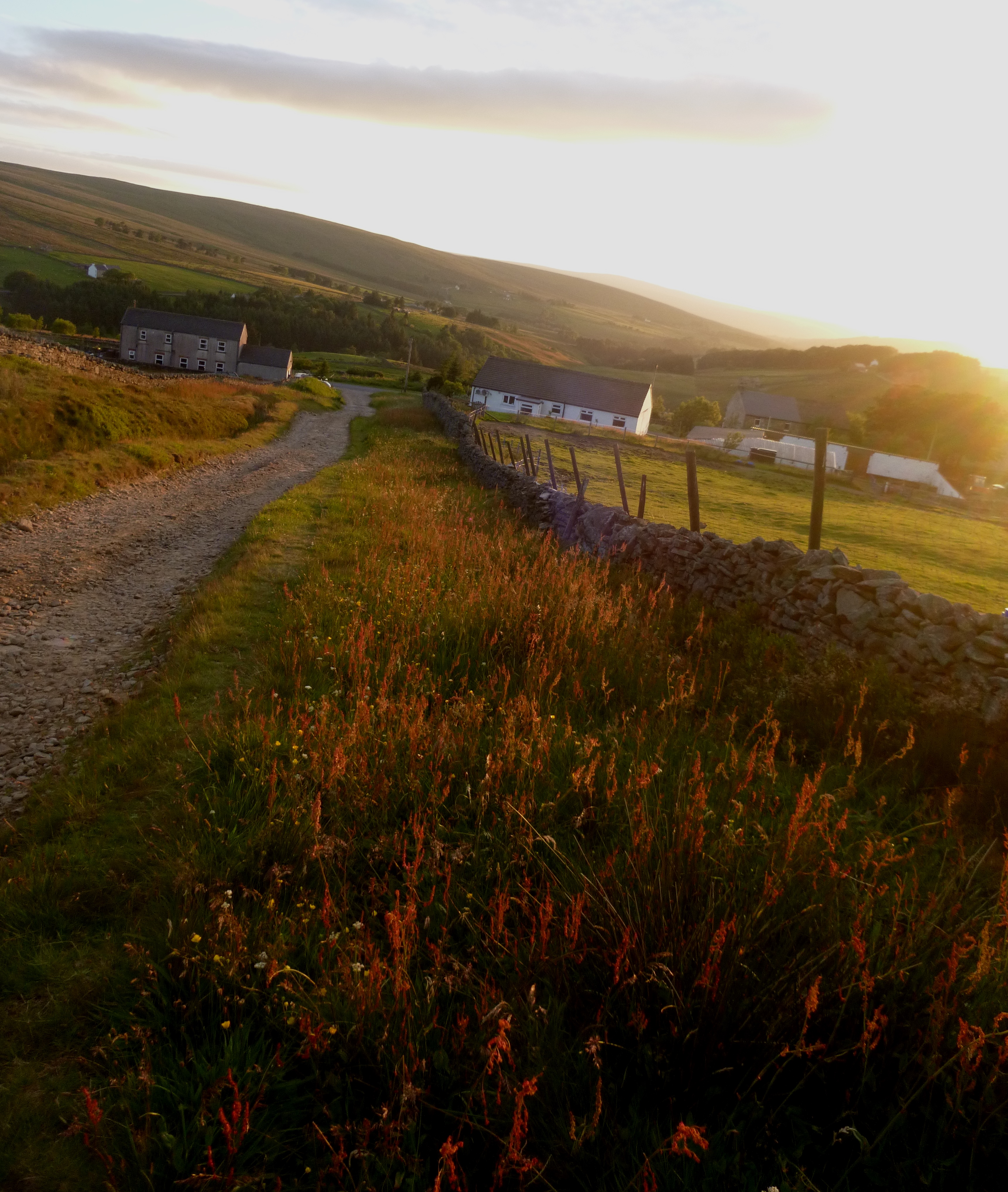
Pass by Philipson’s sheepfold up on your right and across Nan Davison’s Cleugh and continue on below Blackway Head to Carrshield Moor. At a cross-roads of paths go straight on and down to pass the remains of Rushymea and reach the road. Then turn right along the road past Mutton Hall and turn left at the road junction at the head of the West Allen. (This section of road is also on the C2C cycle route).
Coalcleugh GR NY 801451 to Nenthead NY781 437 (Bainbridge Memorial) –
See map
Distance 4.22 km or 2.62 miles
Total distance walked 18.51 km or 11.50 miles
After a short distance, leave the road and follow the trail footpath sign to the right, joining the track with Sunniside on the right. Continue beyond the gate to cross the Alston Cleugh footbridge. Then shortly turn left at the marker post and climb to the higher ground to the County boundary with a wooden gate between Northumberland and Cumbria with views of Cross Fell and the fells of the North Pennines.
On the drop down into the Nent Valley, keep to the line of the marker posts across tussocky grass and reed clumps, over uneven ground from quarrying and shallow mine workings as far as the three-way footpath sign and a bench a few yards above and beyond the ruins of Roughside. Turn sharp left to join the fellside track back past Roughside and follow it all the way to the road and the footpath sign to Nenthead.