
Downloadable Route Summary & Instructions for Ninebanks to Allendale Town
Summary
The reminders of Isaac Holden life are much in evidence. Over the last two hundred years what is remarkable is that so much has survived. The small holding at Redheugh was Isaac’s birthplace in Mohope. While only a short distance further is the profile of the workings of the Keirsleywell Mine. This was where Isaac worked as an 8 year old sorting ore and then a few short years later he joined his brother and father as a lead miner in a family partnership at this mine.
It was a hard life but the same livelihood was shared by hundreds throughout the valley. Until out of adversity, when his earnings slumped below subsistence level he had a welcome change of fortune, when he tried his hand at selling tea from door to door.
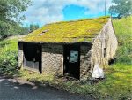
Both Isaac’s parents and his older brother Jonathan were buried at St. Mark’s Church, Ninebanks. A short distance up the road is the purpose-built hearse house now fully restored. This melancholy venture was his last with the funds raised before his own death in 1857. It was only the year before when he presented with pride the hearse on the grand occasion of the official opening of the schools at Ninebanks. Take the time to visit the hearse house and put your name in the visitors’ book.
Isaac was fortunate, for just when lead mining was at a low ebb in the 1830s, the market for tea was growing year on year. The success of the Holden enterprise probably owes more than a little to custom from the extended Holden friends and family in the neighbourhood. Neither should it be underestimated the insatiable demand for tea in this staunchly Methodist community. Around Ninebanks alone were six temperance oriented Methodist chapels keen to indulge in “the drink that cheers but does not inebriate”.
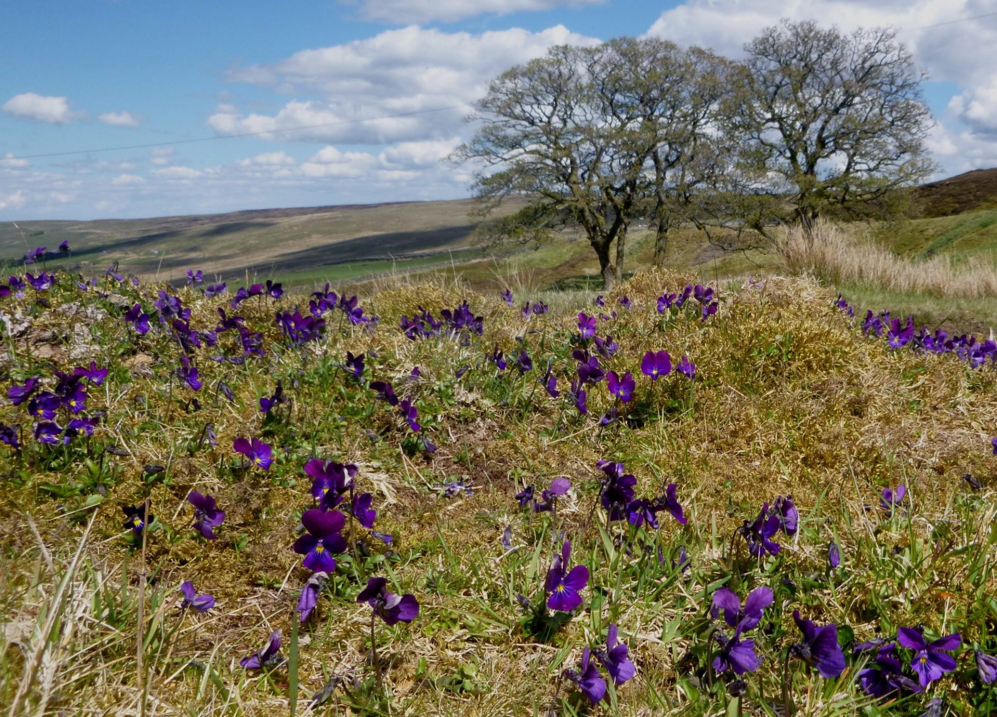
The trail follows the well-trodden path then made by travellers and pedlars making calls on households along the way. From Ninebanks the route then climbs towards Dryburn and briefly meets the road on Leadgate Bank and continues into Monk Wood part of the Whitfield Estate. Before taking another climb out of the West Allen valley and over to the East Allen past Keenley Chapel. First visited by John Wesley in 1746 and is now the oldest chapel in continuous use in the world from 1750. The path continues to drop gently down between where sheep and cattle graze for a riverside walk back by the River East Allen back to Allendale. The impressive memorial to Isaac’s memory in St Cuthbert’s churchyard (behind the Allendale Co-op) can be admired before you return to Isaac’s Well. Allow time for a celebratory tea or the drink of your choice.
Accommodation and refreshments are available in Allendale
Distance: 15km, 9.5 miles. Allow 4.5 hours
Difficulty: Medium
Max height: 348m Min height: 175m Total Climb: 406m
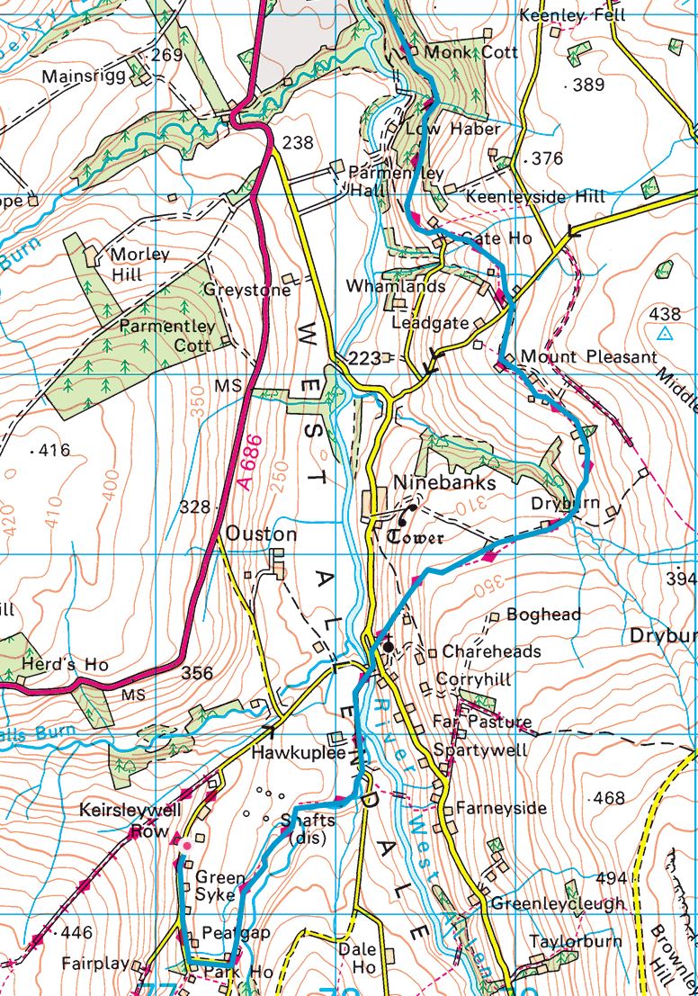
Maps: Ninebanks to Allendale Town Map
Route Instructions
YHA Ninebanks to Leadgate Bank (6.08 km or 3.77 miles) – See map
From Ninebanks Youth Hostel turn right down the road and turn left at the bend before Park House farm and round the usually open gate down to the next bend and enter the drive for Redheugh Cottage. Continue around the inside perimeter, out the gate and follow the path on the broad ridge of fields between the burns dropping down to a lone ash tree to ford the Blind Burn before the confluence with Mohope Burn.
Follow on to below a lone ash tree and cross the burn. Follow the path by the Mohope Burn to near Malakoff Bridge. In dry spells the water disappears to expose the bedrock. Turn left at the road and right at the junction before Blackpool Bridge over the River West Allen. At the end of the bridge go sharp right up steps to the bank beneath the trees to meet the Ninebanks – Carrshield Road up the West Allen.
With the chance to visit Ninebanks Church and the hearse house (turn right on the road for 150 yards) then return to the trail. The route continues left on the road beside the fence and then crosses over a stile in the wall. Then up through a green metal kissing gate with a footpath sign for the trail and to Mount Pleasant. Continue up the path, next to the tarmac track with good views back over the Mohope valley and the ground already walked.
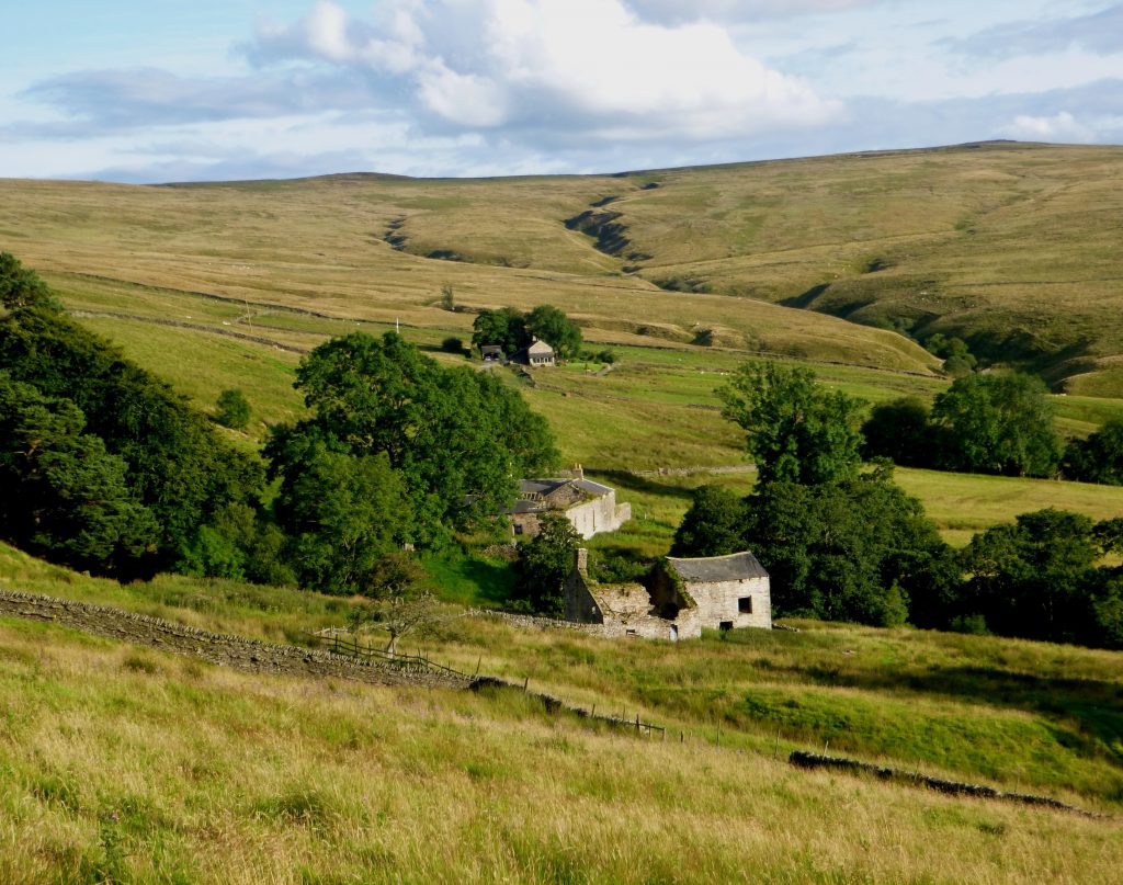
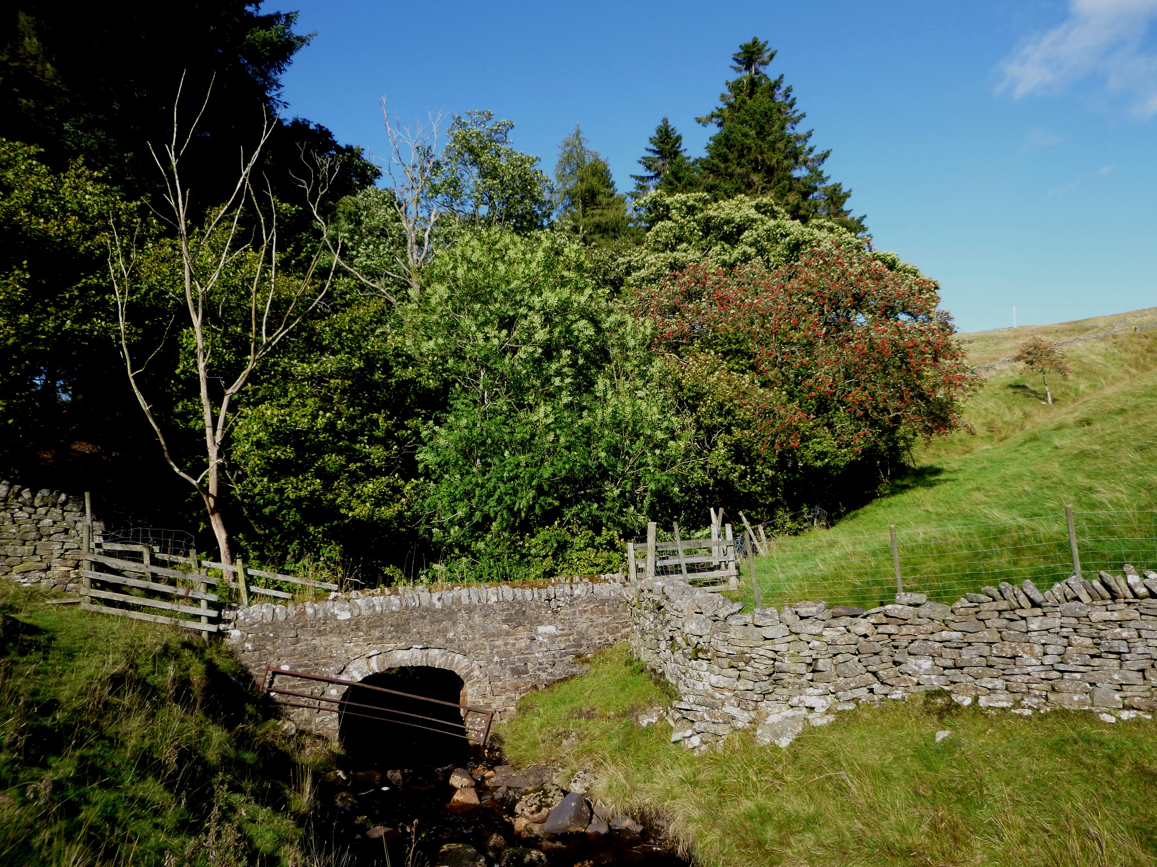
Look out for the marker posts pointing to the ladder stile in the drystone wall in the top far corner. Once over the stile continue along the wall on your left and along and climb over the next stile a short distance ahead. A couple of tall yellow capped marker posts show the way through extensive clumps of soft reed and out by the field gate near Pasturehead. Continue close by the track past Far Dryburn. Then over a short wet and muddy section before the path drops steeply down to the Dryburn footbridge. Cross over and keep left up to the next stile and climb up and across to the right side of a solitary alder tree. Further on is an open sided stone bridge to the marker post by the track, which passes properties to the left before the road at Leadgate Bank.
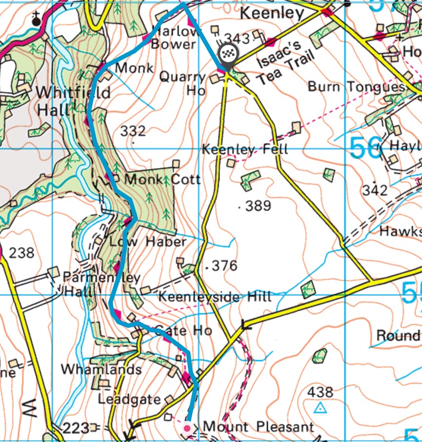
Leadgate Bank to Keenley Green (3.97 km or 2.47 miles) – See map
Cross the road and drop down a few yards and follow the trail footpath sign, below Newhouses through the wicket gate and then on over a stile and drop down to the right of a property. At the next gate with a wall stile follow further down across the field and climb gently back over to other side, where another path intersects to the right and upwards. Keep left through the field gate ahead and below the property Low House above on the right with a short distance to the field gate with a trail logo on your right.
Follow the track down only as far as the marker post above where the path divides. Take the path up to the drystone wall to the wooden gate into Monk Wood. Carry on the track through the plantation as far as The Monk farm. Turn right at the footpath sign post through the field gate up to a wicket gate with reeds and tussocks, up and below the power lines to a kissing gate half way up.
Climb on to the top at Harlow Bower between the farm and the barn on the right. A short distance further on lookout for the low stile where the footpath crosses the farm access track. Turn right and continue along over ladder stiles until you meet the road, below Quarry House at Keenley Green.
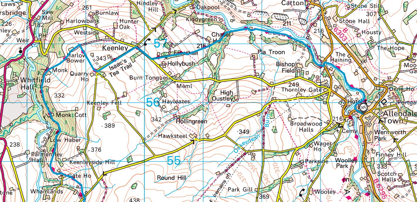
Keenley Green to Allendale – Isaac’s Well (6.28 km or 3.90 miles) – see map
Turn left over the stile on to the road and walk to the crossroad by Keenleywell House. Turn right along the road before the trail sign left down to Keenley Chapel. Follow down past the chapel, unfasten the iron gates, if they are closed. Then head down to the wooden gate and enter a narrow copse as far as the beech hedge and over the stile at the end.
Keep left and continue along the fence line and tree shelter belt and cross over the track for Chapel House and over the stile and field gate. Continue a short distance further to the stile near the Crockton Burn. Keep left and along at the footpath intersection and follow the signed directional arrow on the marker post. A little further is a wicket gate then down with a drop through mixed woodland to cross the burn over Maggie’s Bridge to join the riverside path along the East Allen.
Follow the footpath upstream by Bridge Eal and through the fields beyond to Tommy Stout’s Wood and onto the road at Allen Mill Bridge. Turn left over the road bridge then to the right and follow the riverside path to the road before re-tracing steps into Allendale to Isaac’s Well.