Where it is:
The whole of Isaac’s Tea Trail
Getting to the Trail
Other than getting to the Tea Trail by car, some stages of the trail are accessible by public transport and there are also local taxi companies available to ferry you between your accomodation and your starting and ending points on the trail.
Taxis:
For local taxis, try:
- Kevin Mackey at Langley Taxis based in Allendale. Phone: 01434 684658. See more on their Facebook page
- Alston Moor Taxi, who have a 8 seater licensed taxi available to be pre-booked for transfers. Phone: 01434 381230 or mobile: 07517000828.
For baggage handling and transfers, try Brigantes
Public Transport:
Train:
- There are regular train services between Carlisle and Newcastle providing closer access to the trail from stops at Brampton, Haltwhistle and Hexham.
Bus:
- There are regular bus services between Hexham bus station and Allendale Town, some of which start / end at Hexham Railway Station.
- There is a daily bus service to Alston and Nenthead from Carlisle and Brampton
- Daily bus services from Halwhistle to Alston
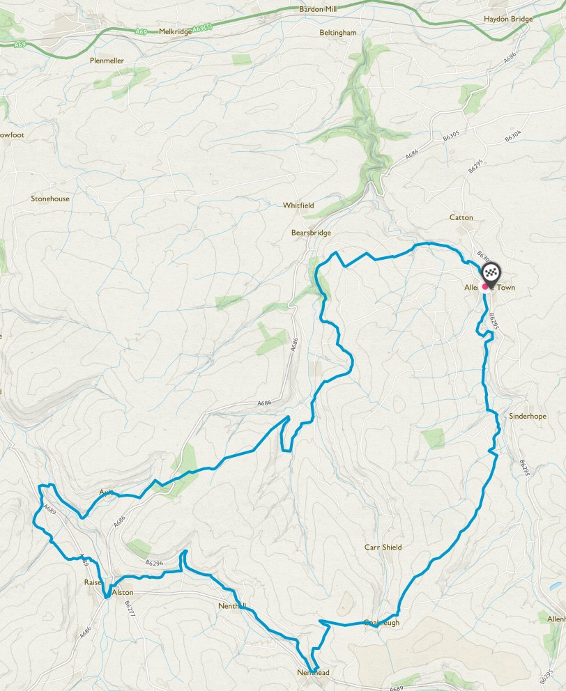
Isaac’s Tea Trail – The Stages and the Circuits
The trail was originally documented as a clockwise circuit but has now been enhanced to include directions for both a clockwise and an anti-clockwise route.
There are separate maps for each stage to provide a more detailed view of the route. The maps for each stage consist of a summary map showing the whole stage, plus 2 or more detailed maps showing sections of the stage.
The maps for the clockwise circuit are:
- Allendale Town to / from Nenthead
- Nenthead to / from Alston
- Alston to / from Ninebanks
- Ninebanks to /from Allendale Town
The maps for the anti-clockwise circuit are:
- Allendale Town to St Mark’s Church Ninebanks
- St Mark’s Church Ninebanks to Alston
- Alston to Nenthead
- Nenthead to Allendale Town